[360Labs.ai]
{ 360Labs }Case Study
{ Our Products }· Live

GeoLink

Drone and ground-robot inspection intelligence delivered as GPS-mapped reports within two hours.

GeoLink
// overview

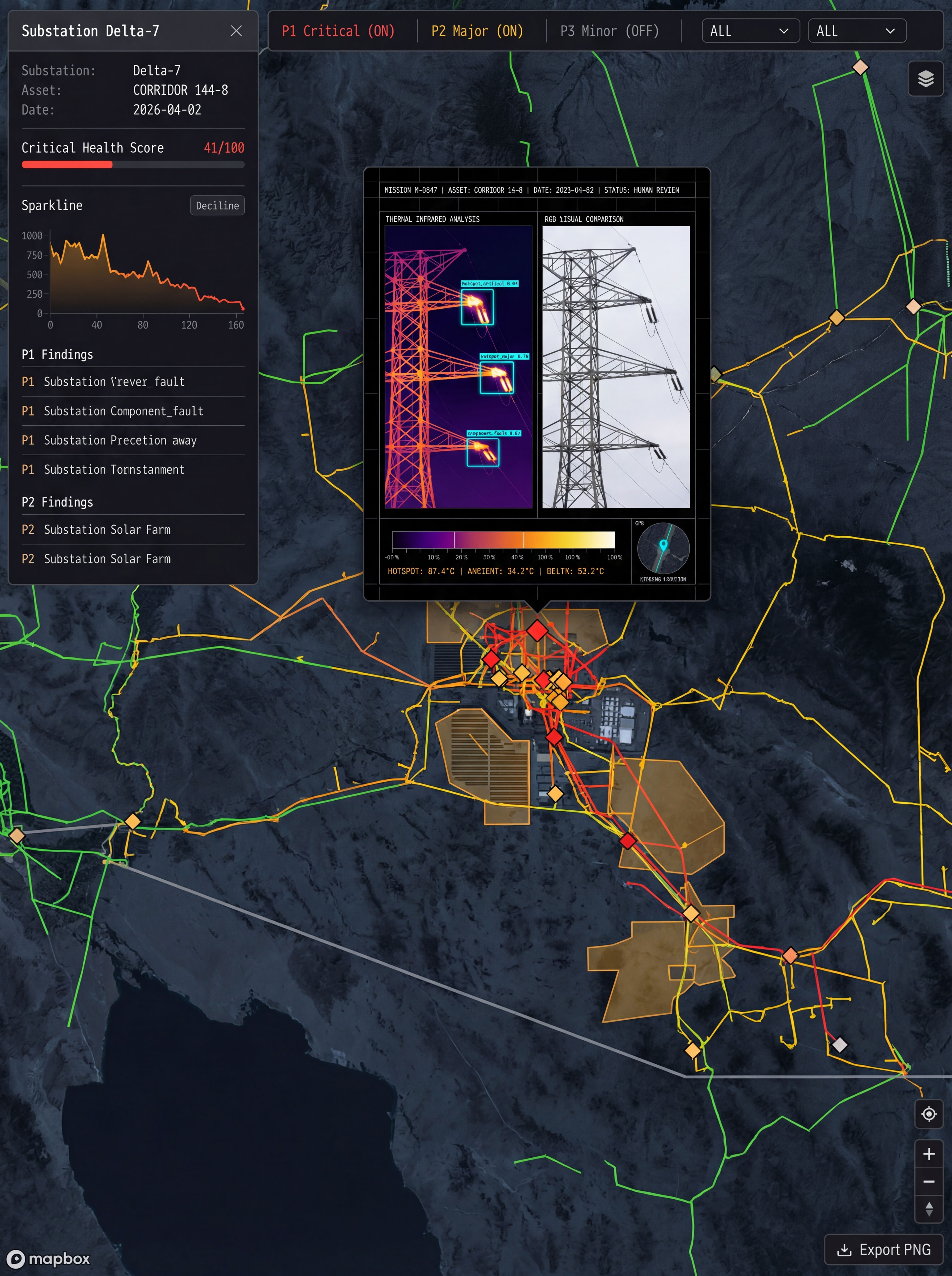
A three-layer inspection intelligence platform. Field collection (drones + ground robots with thermal/RGB/zoom sensors), an AI intelligence layer (YOLOv8 defect detection with human-in-the-loop validation), and a client decision layer (live web portal with GPS asset health map, severity-ranked findings, historical comparison, maintenance tracking). Reports delivered within two hours vs 5 to 10 business days for traditional methods.

// specs

Specifications

Field LayerDrones + ground robots (thermal/RGB/zoom)
AI LayerYOLOv8 + human-in-the-loop analyst review
DeliveryGPS-mapped report < 2 hours
Infra12-service AWS ECS Fargate stack
// features

Features

  • 01Drone + ground robot data collection (thermal, RGB, zoom imagery)
  • 02YOLOv8 defect detection on GPU workers with analyst-in-the-loop validation
  • 03P1 to P4 severity classification for every detected anomaly
  • 04React + Mapbox portal with GPS asset health map and annotated images
  • 05Historical comparison, maintenance tracking, CSV / GeoJSON export
  • 069-step automated workflow on a 12-service AWS ECS Fargate stack
  • 07Reports delivered in under 2 hours vs 5-10 days for traditional inspections
// architecture

Architecture

INSPECTION PIPELINE

Field Operations (drone + ground robot)
AI Detection Pipeline (YOLOv8)
Severity Classifier
P1 Critical
P2 Major
P3 Minor
P4 Informational
Client Portal (GPS-mapped report)

Interested
in GeoLink?

Let's discuss how this can work for you.

Get in Touch →
// end of case studyGeoLink